
FAQ (2016-2022)
About the project
- Upgrades to alignments to improve sightlines and visibility.
- Improved road gradient changes (i.e. reduced crests and dips).
- Installation of roundabouts to reduce speed along Jumping Creek Road.
- Installation of kerb and channel to replace open drains.
- Installation of safety barriers to improve road safety.
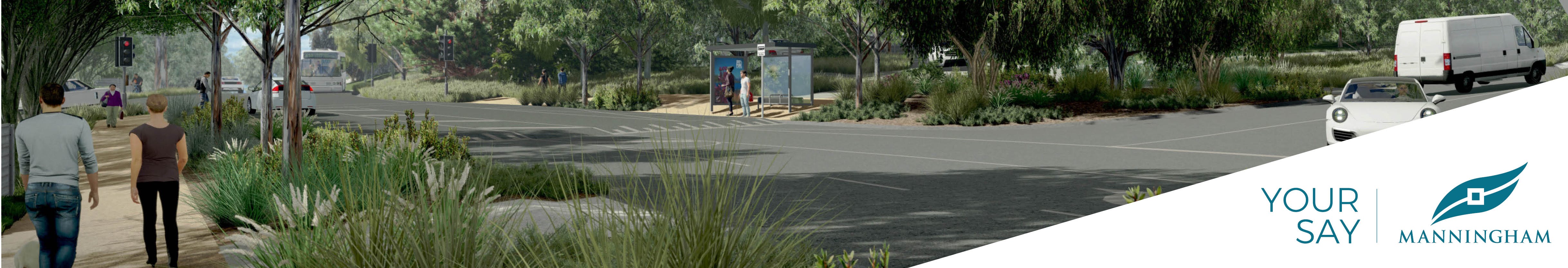
- Construction of a new mixed-use path to facilitate sustainable transport options.
- Construction of several fauna road crossings.
- Improvements to access to private driveways.
- Removal of vegetation to accommodate the works where necessary and the undertaking of associated re-vegetation as required
About Jumping Creek Road
Jumping Creek Road provides an important five kilometre link within Manningham, between Ringwood-Warrandyte Road in Warrandyte and Homestead Road in Wonga Park.
It connects the local communities of Warrandyte and Wonga Park and existing employment and retail precincts in Croydon, Chirnside Park and Lilydale. It serves as an important transport corridor between the municipalities of Manningham, Maroondah and Yarra Ranges.
This road currently carries in excess of 8,100 vehicles per day (vpd), which is expected to double to 15,000 vpd by 2035.
The road is located within an environmentally significant landscape with valuable native vegetation and fauna and is also identified as being located in a ‘high bushfire risk’ zone.
Why is the road proposed to be upgraded?
A number of safety issues have been identified with Jumping Creek Road, which are likely to become more prevalent with current traffic volumes forecasted to double within the next 15-20 years. Manningham Council is committed to safety and will be investing in an upgrade to ensure the road meets a minimum standard, complies with legislation and meets community expectations by delivering safe, sustainable, functional and site responsive infrastructure that protects and enhances the local landscape.
What safety issues have been identified?
Between 2012 and 2016, a total of 17 reported vehicle crashes resulted in casualties along Jumping Creek Road. This included seven crashes causing serious injury requiring hospitalisation. Many of these crashes involved vehicles leaving the road and colliding with objects on the side of the road.
Given the important function of this road within the network and safety issues associated with increased road use, there is a general expectation that the road will need to be progressively upgraded into the future.
What consultation has been undertaken for this upgrade project?
Community consultation helped to inform the Jumping Creek Road Development Framework, which is the framework for this upgrade project.
In 2017, a community reference panel was formed to provide ongoing feedback on the design, development and construction of Jumping Creek Road.
The reference panel were involved in planning for the first stage of works, between Ringwood-Warrandyte Road and Nelson Drive, which is now complete.
Feedback from the community also helped informed the concept plans, and we also worked closely with the Jumping Creek Road Community reference panel in the development of these.
What are the benefits of this road upgrade?
As well as improving the safety of this road, the project will provide increased vegetation for the area, a mixed use trail for walkers and cyclists that links the entire road, wildlife protection measures, improved road useability including roundabouts at Hooper and Hartley roads and an upgrade to the township intersection and streetscape.
What is the purpose of the Jumping Creek Road Development Framework?
The purpose of the Development Framework is to consider options that will address the safety, environmental and functional issues identified for Jumping Creek Road and provide guidance on minimising vegetation impacts, rural amenity and road user needs.
It also contains assessments on traffic and speed counts, road classification detail, crash statistics, applicable environmental and planning requirements, general biodiversity, flora and fauna, native roadside vegetation assessments and proposed concept design plans.
What upgrade works are proposed to be constructed and what improvements are expected?
The concept design encompasses future improvements to Jumping Creek Road that will involve the following works:
About the Concept Plans
What urban design principles were used for this project?
Design principles were developed in line with our Green Wedge Infrastructure Guidelines, which ensured we maintained the existing look and feel of the environment, provided wildlife protection and increased opportunities for revegetation.
The road design at key intersections including at Hooper and Hartley Roads and at the entrance to the Township and Warrandyte State Park were completed in line with best practice guidelines, ensuring the road remains safe, whilst balancing the look and feel of the road.
The location of safety barriers has been designed in line with design guidelines and risk assessments.
Why do we have to align the road at 191 Jumping Creek Road?
This section of road is a significant safety risk for road users and therefore the road alignment is essential.
What will the works involve and will there by impacts while works take place?
Early works are expected to commence in early 2022. As with all road projects, there will be impacts to road users and local residents, however we will aim to keep these to a minimum.
Information will be provided in regards to works and detours as the detailed design phase takes place and information becomes available.
What about emergency service access?
Before works commence, we will consult with the emergency services on the proposed timings and construction methods, including any road closures.
Emergency services will have unrestricted access to all properties in construction areas.
How will you minimise environmental impacts?
A series of measures will ensure there are minimal impacts to the environment including through the installation of virtual safety fencing, animal underpasses and aerial crossings.
How will you protect biodiversity including fauna and native vegetation?
The project involves the revegetation of the entire Jumping Creek Road corridor with a selection of native and indigenous plants.
How will you protect water catchments / hydrology?
As part of the design process, an in depth environmental study has been undertaken to ensure that the road works do not impede on existing water catchments.
How will you protect and assess cultural and historical heritage assets?
In the development of the design and the planning of the construction, we will work with Aboriginal Victoria to develop a Cultural Heritage Management Plan for the project.
Timings and impacts
Are any trees going to be removed as part of the works?
Yes, the upgrade will require tree removal, however the extent has not yet been identified. The concept design aims to balance the road user needs and safety, while minimising impacts on roadside vegetation and retaining the rural character of the area.
A Planning Permit will be required for vegetation removal and revegetation (as required by Victorian State legislation) and will be provided as part of this project. Further information on the associated impacts will become available through the detailed design process.
What about the wildlife?
Where trees need to be removed as a result of the works, potential fauna impacts will be identified and management strategies will be put in place. At several locations, separate animal crossings will be provided to preserve local wildlife.
What will the project cost and who will be responsible for funding the works?
The current estimated cost for the improvement works along Jumping Creek Road is $17.9 million. The funds are identified in Council’s indicative 10 year Capital Works Program and the works are proposed to be delivered across six financial years, between 2017/18 and 2022/23.
Under the provisions of Council’s Contributory Projects Policy, Council is responsible for funding the upgrade of Jumping Creek Road, road drainage and the mixed-use path, aside from the construction of vehicle crossings, which will need to be funded by property owners.
When will the works start and how long will it take?
Due to the scope of works to be undertaken, it is proposed to that construction will be delivered in several stages.
Works to relocate telecommunications, water and gas lines between Ringwood-Warrandyte Road and Nelson Drive started in stage 1A in November 2018. Construction works are anticipated to start in late 2019.
Will there be disruption to traffic while the works are being undertaken?
Some traffic disruption during works of this scale is unavoidable. However, every effort will be made to ensure that Jumping Creek Road remains open to traffic throughout the entire upgrade period. Traffic delays are anticipated as much of the works will require lane closures and one-way traffic operation to safely facilitate the works.
Works will be programmed to minimise disruption to private properties and maintain emergency access and will generally be undertaken during normal working hours.
How will I be informed of when disruptions will occur?
Local residents will be informed of disruptions via direct mail. Information and updates will also be accessible via the Your Say website for residents and road users.
Residents and road users will also be able to sign up to SMS and email alerts so they can receive up to date information about changing traffic conditions.
How do I view my property on the Concept Plan Reference page located in the document library
1) In the document library, under the heading Jumping Creek Road Concept Plans, open the Concept Plan Reference page(External link).
2) Determine where on Jumping Creek Road your property is located.
3) Note the plan reference number that appears within each box (e.g. E9052.007).
4) In the document library under the heading Sectioned Concept Plans, open the document that corresponds to the reference number.
Approach and considerations
- Reclassification of the road
- Restricting travel speeds
- Restricting types of vehicles and load limits
- Road closure – restricting access to local traffic only
- Rely on the proposed northern arterial road as an alternative
- Do nothing approach
- replacement of the Jumping Creek Bridge;
- improvements at the Stane Brae Court intersection;
- construction of the roundabout at the Ringwood-Warrandyte Road intersection;
- asphalt overlay of the road pavement from Ringwood-Warrandyte Road to Stane Brae Court;
- pavement delineation via line-marking of edge lines along the full length of the road, and;
- relocation and undergrounding of some utility services;
- Pavement shoulder widening and sealing at Vine Crescent to Yarra Road.
Have other solutions been considered aside from upgrading the road?
Yes. To determine an appropriate solution for existing and future Jumping Creek Road traffic. A number of options were considered, including:
Further information on the solution options is available in Section 6 of the Jumping Creek Road Development Framework.
What works have been undertaken in the past?
Since 1999, Council has expended approximately $4 million on capital improvements and pavement rehabilitation works at Jumping Creek Road including:
How will Council design safety barriers for this project?
Safety barriers are proposed to be installed to minimise the loss of vegetation along Jumping Creek Road, arising from the proposed road works and to address roadside hazards. Safety barriers will be selected and designed in accordance with the relevant AustRoads Standards. Specific safety barrier locations, extents and types will be determined during the detailed design process for each respective stage of the project.
How will the road be drained (of stormwater)?
The existing open drains pose a hazard to traffic and it is proposed to remove the open drains and install kerb and channel, drainage pits and an underground drainage system to capture stormwater runoff from the road and direct these flows to points of discharge along the road. This approach will minimise the footprint of the works, thereby minimising impacts on vegetation, and the incidence of uncontrolled nuisance flows discharging to nearby properties, while also improving safety and traffic delineation along the road.
How will the infrastructure materials and finishes be selected (e.g. retaining walls, mixed-use path, etc.)?
Finishes for the works will be selected from options identified in Council’s Green Wedge Infrastructure Guide, in consultation with the community reference panel. Primary considerations will include safety, durability, functional performance, cost, aesthetics and maintainability.
More information relating to the Green Wedge in Manningham can be found at:
How will the works be managed to minimise the risk to the community during the fire danger period each year?
Construction works will generally be staged and programmed to minimise overlap with the fire danger periods.
Work will be limited on high-risk days to ensure it does not hinder safe travel of local residents and road users.
What consultation is proposed during the project?
A Reference Panel of interested residents has been formed to assist with the project development. Community feedback will also be sought on our detailed design process. You can provide your feedback on the Jumping Creek Road Your Say page (yoursaymanningham.com.au/jumping-creek-road-upgrade).
Our consultation aims to gain community feedback in relation to community issues and proposed design relating to materials and finishes, as well as landscaping solutions. Submissions will also be invited in relation to any Planning Permit required for the project, which will be considered through the assessment process.